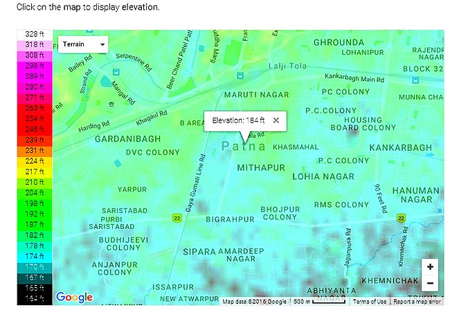
There is no Berlin Wall nor any demarcating line as between East and West Jerusalem. Yet Patna is divided between two halves––one which is prone to flood and ther other, where one can never think of any such natural fury––evn this time when the water-level of Ganga has crossed the record of 1994.
The old Patna––that is Patliputra from the age of Ashok to Azimabad during the reign of Aurangzeb––seldom witnessed flood as this eastern half is situated on a high plain.
In contrast modern Patna which developed during the British period and after independence, face perennial problem of flooding.
Gandhi Maidan in the centre of the city often becomes lake. It is to its west and south that waterlogging is common even if it rains heavily. Be it 1975, 1994, or this time it is this side of Bihar’s capital, which bears the brunt of flood.
Raj Bhawan, bungalows of chief minister, ministers, judges, quarters of legislators and bureaucrats, high court, secretariat, railway stations, administrative offices, marketing complexes, malls, theatres, museums, places of entertainment, flyovers, most schools and collegges are situated in what is called New Capital Circle.
It is relatively old and densely populated part of the eastern part of the city with naroow roads, lanes and by-lanes, which never witnesses any flooding though occasional waterlogging can be seen.
Patna is the rare state capital which is surrounded by so many rivers. From west to east it is situated on the southern bank of Ganga. To its west is Sone, with a chain of canals. They all meet Ganga. Danapur cantonment is at the western outskirts of the city and flood water does not spare it.
To south and east of Patna is river Punpun which circumvent Patna to fall in Ganga east of the city.
In 1975 these two rivers were largely responsible for the flooding of south and west Patna as Ganga was no more in position to take their water. At some places water level reached as high as seven to eight feet.
That much is not enough. Gandak, which originates from highland in Nepal submerges its identity in Ganga just north of Patna. So water of three rivers fall simultaneously in Ganga in the vicinity of Bihar’s capital.
It goes to the credit of ancient and medieval town planners that they chose such a highland to settle in the region surrounded by four big rivers and thus kept the city safe from nature’s fury.
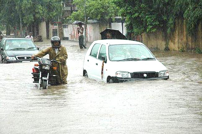
Even as flood water has entered thousands of houses in the western Patna on Saturday morning leading to the closure of schools on Monday and Tuesday, in the eastern half of the city life is, one can say unusually normal. All the educational institutions are open. As a sight-seeing exercise hundreds of people are thronging every day at various ghats to see swelling Ganga.
While thousands of displaced people from diara (riverine region) are being fed by district administration as they have been rendered homelss, there is no such scene in the eastern Patna. While the Patliputra MP (where most part of west Patna falls), Ram Kripal Yadav, who is also a Union minister, is visiting different localities and villages on NDRF boat the Patna Saheb MP, Shatrughan Sinha, (a large part of eastern half of Patna falls in it) is nowhere in the constituency. In fact he was in the state capital a few days back, reportedly to participate in a cultural function.